Local Rankings (GeoGrid)
Track Google local-pack rankings across a geographic grid, with a square or radial (concentric-ring) layout, a rank heatmap, and PDF reports.
User goal
See where a business ranks in the local pack across a map of points around it, and where the gaps are.
- Tier
- Pro+ or Stripe add-on (geo_grid_addon)
- Nav label
- Local Rankings
- Route
- /projects/{project}/local-rankings
- Gates
- geo-grid-addon geo-grid-addon
Prerequisites
- geo-grid-addon active for the org (Pennant + tier/Stripe)
- A tracked location with a business match and keywords
- Credits in the wallet (a scan costs points × keywords)
QA focus
- Layout (square vs radial) chosen per scan and re-derived server-side
- Radial priced/capped by real node count (per-tier cap + 400 hard cap)
- Heatmap + Grid Details render for both layouts; compare guards on geometry
- All routes behind EnsureAddonAvailable(geo-grid-addon)
Overview
Local Rankings tracks Google local-pack position across a map of points around a business — square grid or radial (concentric) rings — so you can see where you rank and where the gaps are.
What you get
- Tracked locations with their own grid config and scan history
- Per-scan layout choice: Square grid or Radial rings (optional default on the location)
- Results map with numbered pins, Pins ⇄ Heatmap toggle, and a Grid Details panel
- Keyword comparison and PDF export (heatmap + geometry)
- Side-by-side scan compare when geometry matches
How it works
- Open Local Rankings, pick or add a location, then Run a scan
- Choose layout, density/spacing, and keywords; the credit estimate (points × keywords) updates live
- Watch pins fill in as each point is checked; expand Grid Details for coverage and averages
- Radial suits dense metros where a square grid is too coarse; over plan node caps disables launch with an advisory
Common issues & false alarms
- Ambiguous business match → confirm the correct listing on the results page
- Grid over the plan node cap → launch disabled with an advisory (lower density or ring spacing)
- Comparing two scans with different geometry → cell-by-cell delta is disabled with a notice
Interactive guide
Step of
What to do
Where to find it
Expected (pass)
Negative cases
Tips
Screenshot pending capture
All steps (reference)
-
Step 1. Open Local Rankings and pick a location
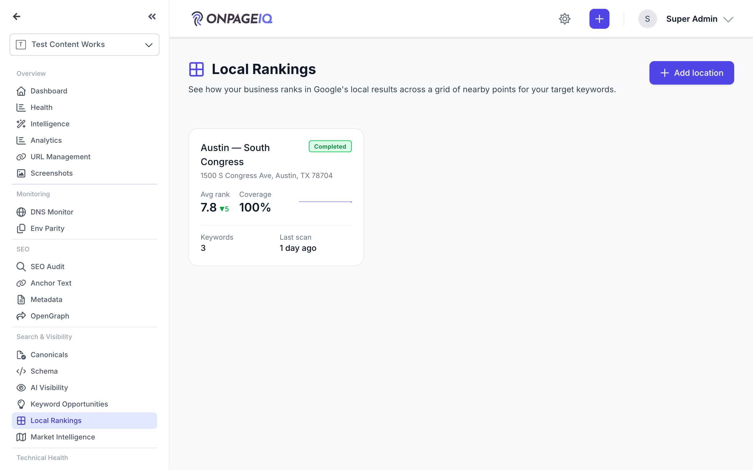
The addon lives under "Local Rankings" in the project sidebar. Each tracked location has its own grid config and scan history. Project-level Places defaults (and Listing Alignment NAP, when that flag is on) live on **Project Settings → Local SEO**.
What to do: Sidebar → Local Rankings (geo-grid.index) → open a location (or Add location).
Where: geo-grid.index
Expected (pass)
- Location cards/list render with the latest visibility grade
- Add location CTA visible
Negative cases (must fail safely)
- Addon inactive → geo-grid.upgrade or 403 on direct URL
-
Step 2. Set a default layout on the location (optional)
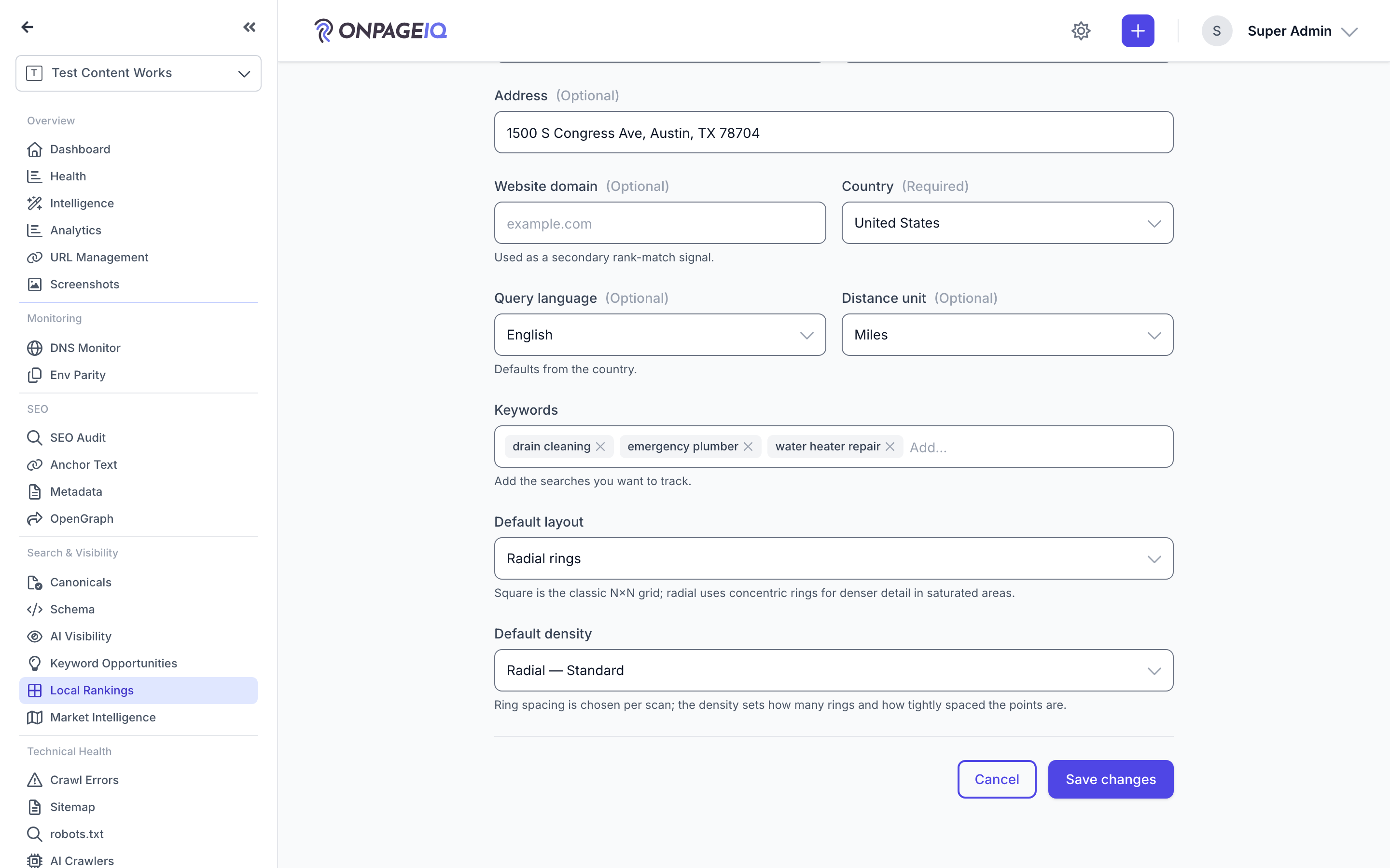
On the Add/Edit location form, "Default layout" chooses Square grid or Radial rings for new scans. Radial reveals a "Default density" picker (Standard / Dense / Max). This only pre-selects the launcher — you can still change it per scan.
What to do: geo-grid.locations.edit → set Default layout = Radial rings → choose a Default density → Save.
Where: geo-grid.locations.edit
Expected (pass)
- Radial choice persists on the location config
- Launcher opens pre-set to that layout + density
Negative cases (must fail safely)
- A deactivated preset falls back to the first active one at launch (no hard error)
Tips
- Leave it on Square for most businesses; switch to Radial for dense urban centers where a square grid is too coarse.
-
Step 3. Run a scan — choose Square or Radial
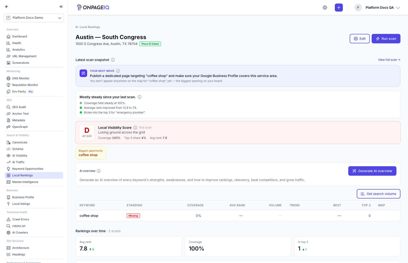
On the location, click "Run a scan". In the slide-over, the Layout control toggles Square grid ⇄ Radial rings. Radial swaps the grid-size buttons for a Density picker (Standard / Dense / Max, each showing its point count, e.g. "~39 pts"), and the spacing dropdown relabels to "Ring spacing" (distance between rings). The credit estimate (points × keywords) updates live.
What to do: Run a scan → Layout: Radial rings → pick a Density → set Ring spacing → Start scan.
Where: geo-grid.locations.show (Run a scan slide-over)
Expected (pass)
- Density presets show live point counts; estimate reflects points × keywords
- Over the plan node cap → advisory shown and Start disabled
- Scan starts and redirects to the live results map
Negative cases (must fail safely)
- Radial is never charged the free first-scan promo price
- Insufficient credits → Start disabled with a top-up link
Tips
- Density sets how many rings and how tightly spaced the points are; ring spacing sets how far the grid reaches. More points = more credits.
-
Step 4. Read the results — pins, heatmap, Grid Details
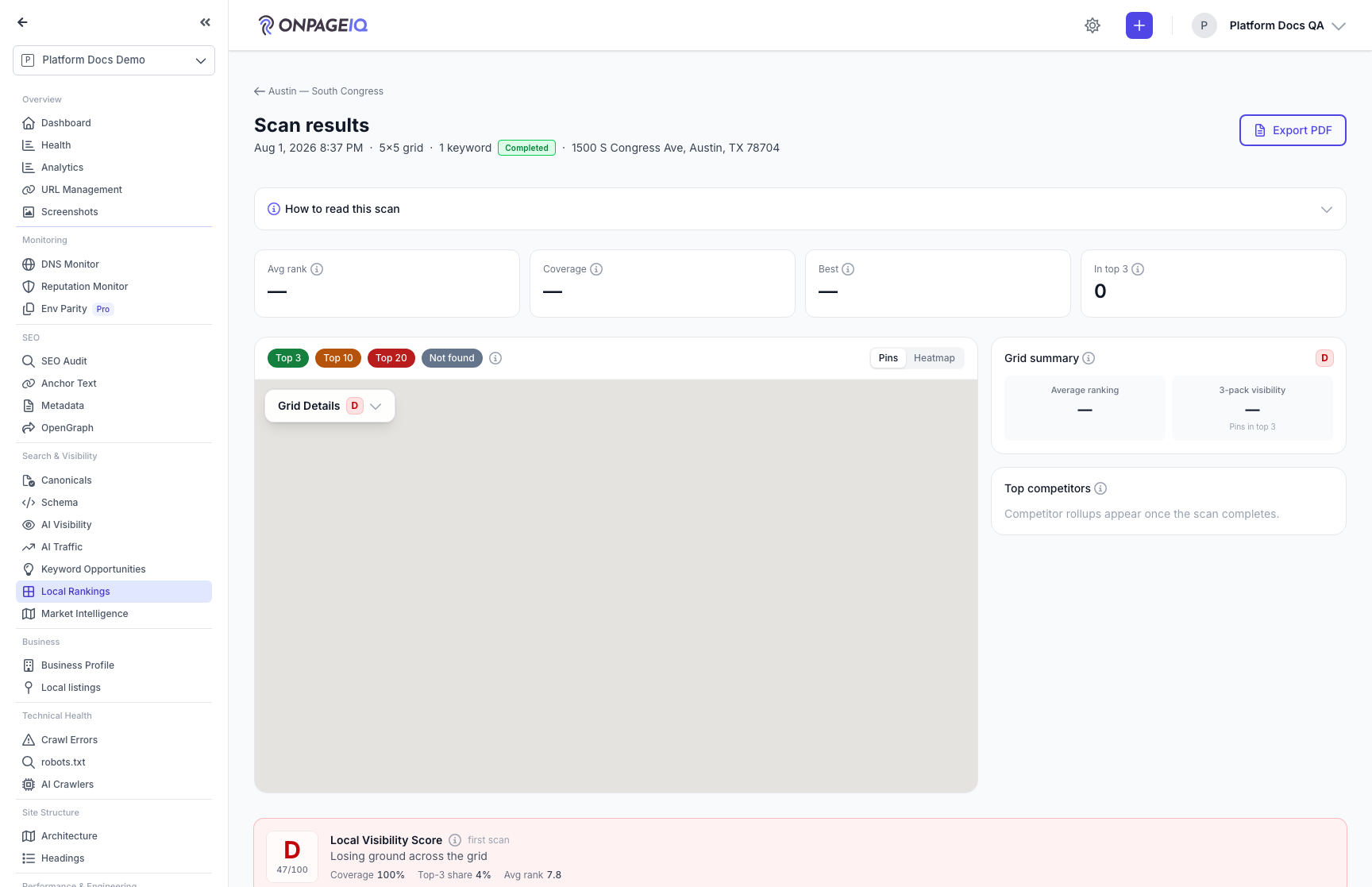
The results map plots each point with its local-pack position (Top 3 green / Top 10 amber / Top 20 red / not-found gray); a radial scan draws concentric rings automatically. Use the Pins ⇄ Heatmap toolbar toggle for the smooth gradient view. The "Grid Details" pill (top-left of the map) expands to show created date, business, keyword, center point, Rings / Ring spacing (or Grid size), radius, coverage, average ranking, and local 3-pack visibility.
What to do: geo-grid.runs.show → toggle Pins/Heatmap → expand the Grid Details pill.
Where: geo-grid.runs.show
Expected (pass)
- Rings render for a radial run; Heatmap toggle overlays the banded gradient
- Grid Details shows radius + coverage and relabels Rings / Ring spacing for radial
- Clicking a pin opens its per-point detail
Negative cases (must fail safely)
- Cross-org run in the URL → 404
Tips
- Pins fill in live as each point is checked. If the live connection drops mid-scan (e.g. during a deploy), the map catches up on its own within a few seconds — no need to refresh.
-
Step 5. Compare scans and export the PDF
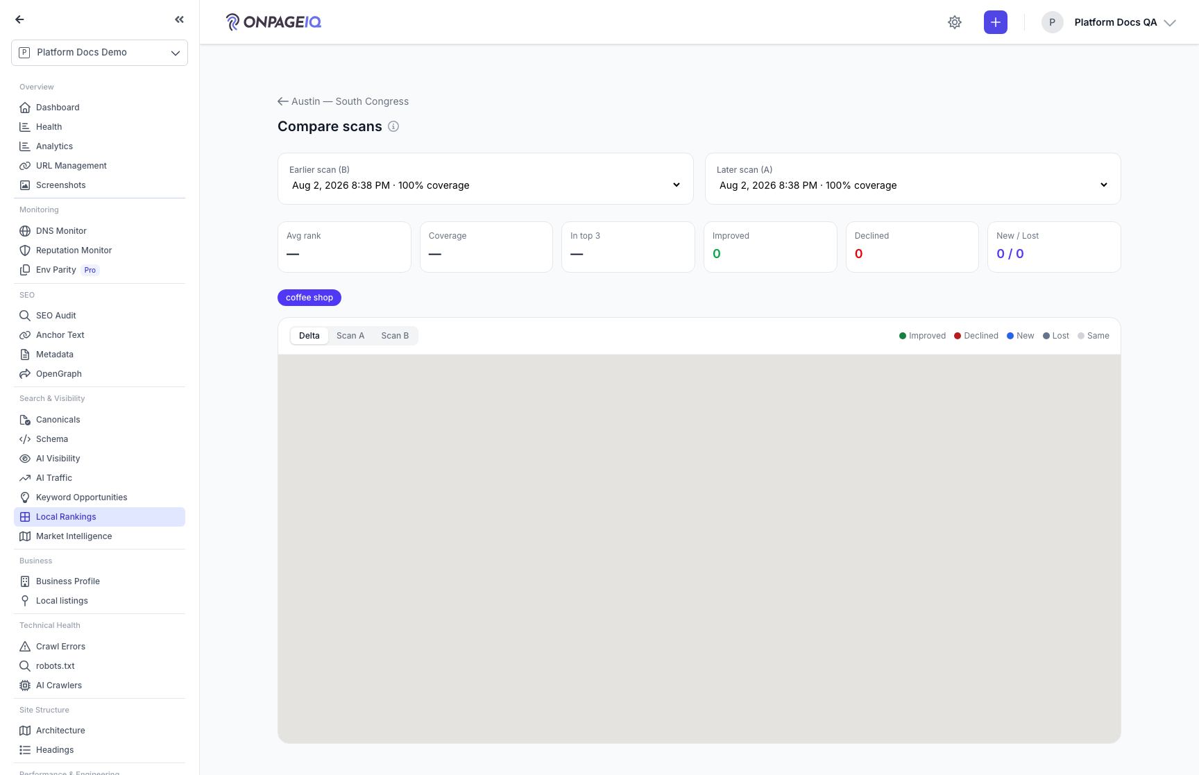
Compare shows two scans of the same location side by side with a per-point delta — but only when their geometry matches (same layout, size/rings, spacing); a mismatch shows a notice instead of a bogus delta. The PDF export includes the rank heatmap and the radial geometry.
What to do: geo-grid.runs.compare (pick A/B) and Export PDF on the results page.
Where: geo-grid.runs.compare
Expected (pass)
- Same-geometry pair shows the delta; different geometry shows the incompatible-geometry notice
- PDF downloads with the heatmap + N-ring / N×N header
Negative cases (must fail safely)
- Export while a scan is still running → blocked with a message
-
Step 6. When the Google listing itself changes
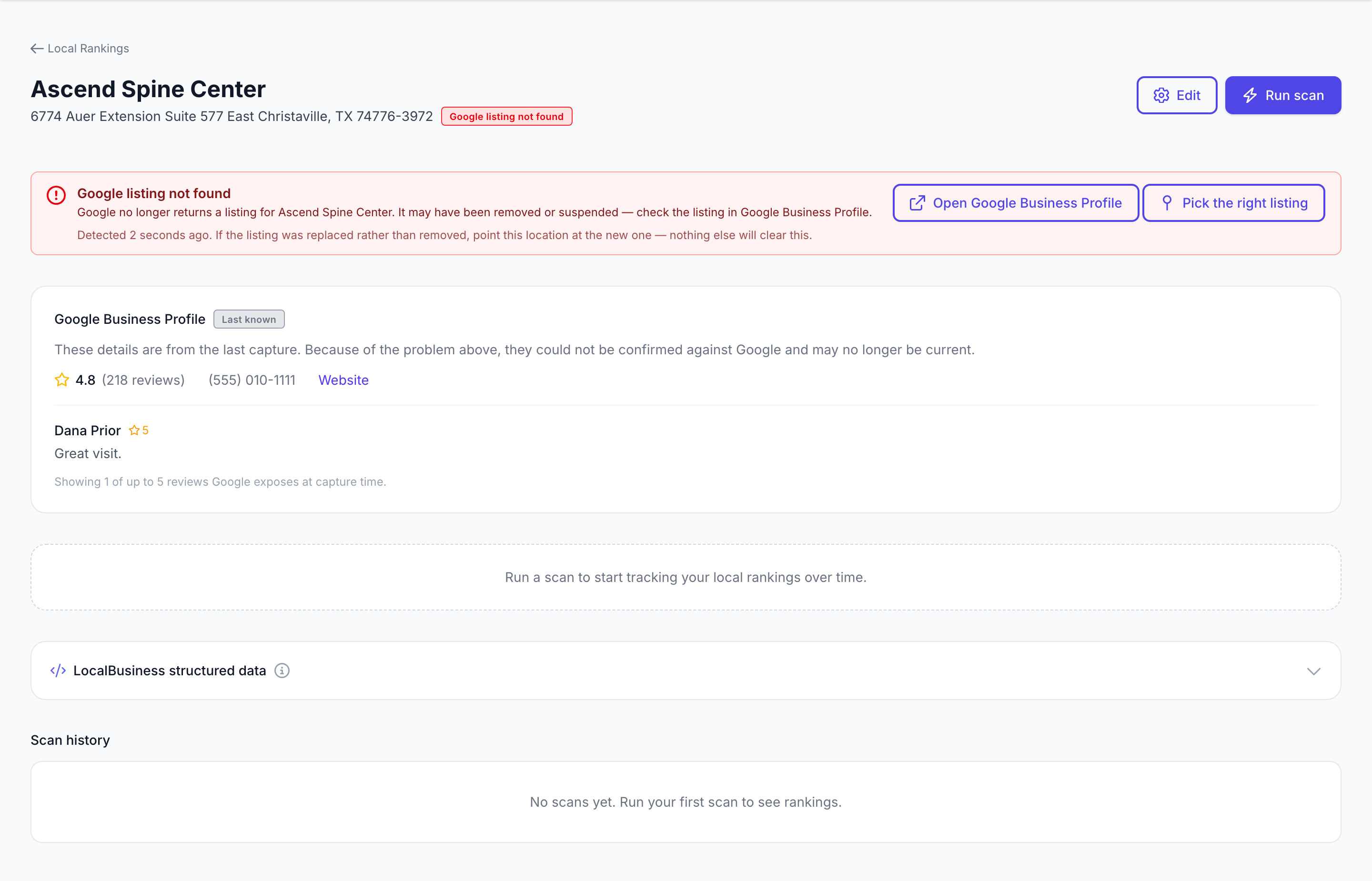
A scan finds the business by its Google place ID. When that stops resolving across the grid, one Places lookup tells apart the three things it can mean — the listing was removed, marked closed, or renamed — and the location page says which. The healthy "Place ID linked" badge is replaced by the problem, and the Google Business Profile card below is marked **Last known**, because its saved rating and reviews are the last capture rather than the live listing. A removed listing usually means Google deleted and recreated it, which mints a **new** place ID the old anchor can never match again. That is why the panel offers "Pick the right listing" rather than promising the warning will clear itself: nothing but re-anchoring will clear it. A closed or renamed listing still exists, so those link to the listing and do clear on their own once Google confirms it.
What to do: Open a location whose listing has changed (geo-grid.locations.show).
Where: geo-grid.locations.show
Expected (pass)
- The healthy badge is replaced, not sat beside, by the problem
- Google Business Profile card shows "Last known" and drops its View on Google link
- Missing listings offer Google Business Profile; closed/renamed link to the listing itself
Negative cases (must fail safely)
- Most of the grid failed → no alert (our bad night is not their listing gone)
- A business that has never ranked → no alert ("never found" is not "no longer found")
- A viewer without manage permission → told an editor must re-anchor, not shown the button
Tips
- The warning is raised and retired by the same evidence — Google. A scan finding the business again does not clear a "marked closed", because a closed business still ranks.
-
Step 7. Choose how loud a project's alerts are
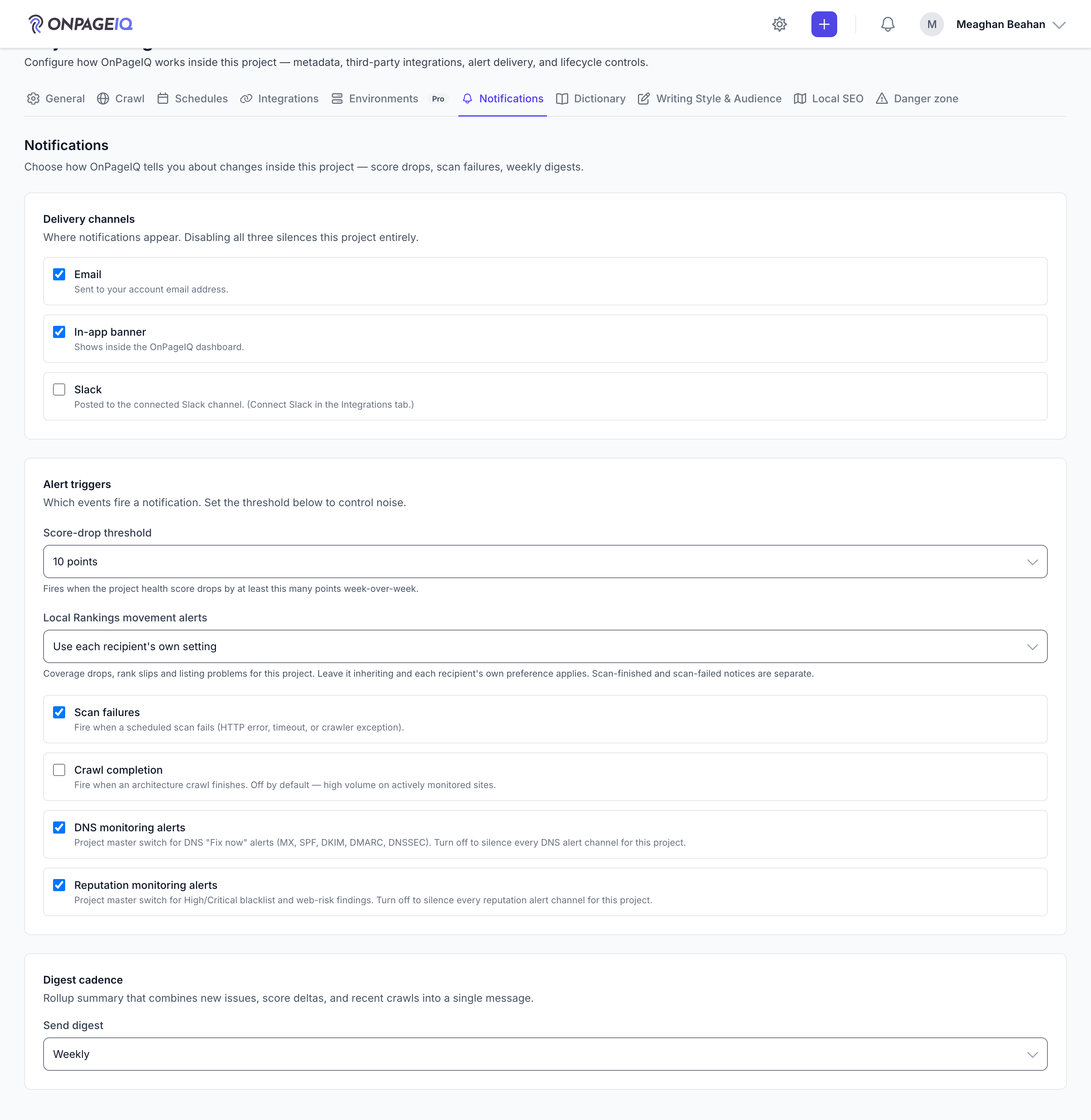
Alert delivery is set per project, on **Project Settings → Notifications**, next to the DNS and Reputation switches. Leave it inheriting and each recipient's own preference applies; set it to say the same thing for everyone on this client. It governs movement alerts — coverage drops, rank slips, and the listing problems above. Scan-finished and scan-failed notices are separate, and which channel anyone receives on is still their own setting.
What to do: Project Settings → Notifications → Local Rankings movement alerts.
Where: projects.settings
Expected (pass)
- Blank means inherit — it is stored as null, not as a value
- Only visible when the addon is available for the project
Negative cases (must fail safely)
- One recipient with two projects on different settings → each project is honoured separately, in one digest
Related guides
Billing & Subscriptions
Manage subscription tier, purchase credits, add-ons, and view billing history.
Integrations (GSC & GA4)
Connect Google Search Console and Google Analytics 4 per project.
Exports & Reports
PDF/CSV/JSON/XLSX exports for scans, issues, metadata, and org reports.
Listing Alignment
Confirm a location’s business identity on Project Settings → Local SEO, then audit name/address/phone/website alignment across website, schema, Google, directories, and Apple/Azure — with honest Not tested when a source is unavailable, plus findings and tasks when sources disagree.
Local Listings
Match BBB, Yelp, Angi, Trustpilot, and G2 listings to a project (Google Business Profile sync planned), confirm the right business, and surface reputation proofs in Business Profile, Local SEO, and Intelligence.
Competitors
One curated competitor list per project — grounded in real ranking data, corrected by you, and reused by Keyword Opportunities, AI Visibility and reports.